What's it like to work at Ubilabs?
Interviews Emma Tracey
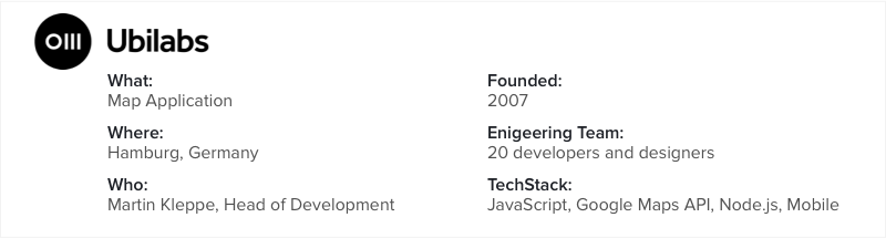
Ubilabs are specialists in interactive map applications. The Hamburg-based company is continuously pushing the boundaries, from mapping Yosemite’s iconic El Capitan to creating a Street View of the world’s largest model railway. At the technical helm is Martin Kleppe, Head of Development and a passionate developer and active member of JS community.
Ubilabs mapped El Capitan, the mystical summit which is over 1,000 metres high, at the centre of Yosemite National Park in California. Can you tell us about the project?
Google has been running its Trekker Program since 2013 with the aim of making some of the world’s most beautiful peaks accessible to everyone. El Capitan is the first vertical street view trek that Google have ever done. We were responsible for designing and launching the Google Street View Trek microsite. It was a very exciting project to work on!
How was the project organized?
Google came to us with the idea and we started to brainstorm. We began to prototype in the browser. There were a number of challenges right from the start. The first was to create a “map” of a vertical trek. Maps are usually viewed from above, so a vertical trek challenges this idea: we used a photo from El Capitan and put an animated SVG path on top. A second big challenge was to highlight special areas in the panos and created “sticky” hotspots that provide more info about the content.
What other projects have you worked on with Google?
Mount Everest Khumbu was another awesome project we worked on. And Miniatur Wunderland here in Hamburg Germany, a Street View of a model railway, which was built to scale of 1:87, was pretty special too. For that we won a Webby Award! For the Wonderland project we built the cameras used to capture over 10,000 photos, which we then pushed the images into Google’s Street View pipeline.
Ubilabs is continuously trying and testing new technologies. What technologies excite you at the moment?
We are working on some really cool stuff. It has become possible to code interactive VR scenes on a mobile browser using JavaScript. And we are using WebGL and Three.js on top of the Google Maps API to draw millions of data points and make them interactive. This was not possible until quite recently because of the limitation of CPU power.
How did you become the Google Maps Partner?
We worked really early with the Google Maps API. We got in contact with the developers of the Google Maps API and we also had a strong connection on the sales side. In 2013, Ubilabs was awarded the Premier Partner status based on our expertise and success in helping customers deploy and use Google Maps for Work solutions. Also thanks to our teamwork with Google, we are one of just two Premier Partners in Germany.
How does your partnership with Google work?
Google offers the Google API without any additional service. You can use Google Maps for free under certain conditions: it has to be public, you can’t have a login, and so on. In other cases, clients might call Google just because they need help to implement the APIs. And Google will pass that customer on to us for help them with the technical implementation or license-related questions.
What are the key skills of developers working on interactive maps?
We work on quite complex technology, which is frequently very new. You don’t need to be someone with a computer science degree but you should be curious and passionate. You have to have a good way to structure your work and a feeling for how to make code easy to understand and manage for others. Good visual sensibilities are also essential because maps are so visual: colour, typography, how to use lines and stuff like this is all very important.
How are projects organized at Ubilabs?
We are not an agency and we are not a tech startup focused on one project – we are somewhere in between. At any given time we have people working on different technologies – one focused on 3D, one focused on Google infrastructure, for example. And our projects can range in length from 5 days to 1 year. Our developers and designers like that we have new projects continuously and that we are not bound to one technology decision. It’s more like continuously trying something new, and improving or rejecting technologies along the way.
What excites you about the future of maps?
There is so much going on with interactive maps in the browser, so many different levels coming together. You can really pack a lot of information into a map. There are so many new technologies emerging every day.
What is it like to found a startup in Hamburg? What are the advantages?
We are not a startup anymore, but 10 years ago, when we were a startup, there was very little going on in Berlin. Everyone said that it’s not the right place to go. It changed hugely in the last five years of course. Nonetheless, there are some great developers in Hamburg and a good demo scene. Recently I co-organized the JSUnconf here in Hamburg and I also organize the Hamburg JavaScript meetup. Aside from work, Hamburg is a nice city to live in – it’s small and focused. It is super green and people are very nice.
Join Honeypot today and receive 4 interview invites or more in three weeks.